GPS-enabled maps of trails and parks in the Rochester, NY region, for your iPhone and iPad
Brand new design! Search and explore parks and trails faster and easier than ever.
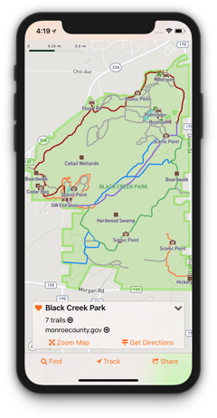
GPS-enabled Interactive Maps
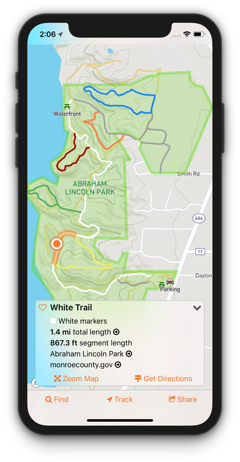
- Tap anything — parks, trail lines, location icons, for instant access to info about your selection
- See trail names, blaze colors, and distances
- Find places to hike, find a pavilion to throw a party, and explore other outdoor activities near you
- Find bathrooms, trailheads, playgrounds, shelters, scenic points, fishing, campsites, and more
Find Your Destination
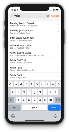
- Browse locations grouped by park or trail system
- Search anything by keywords or browse a list of nearby locations
- Save a list of favorites for quick access
- Get driving directions to parking lots, trailheads, shelters, and more
Get Social
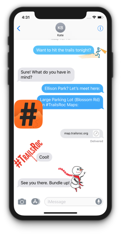
Share a link to your map via message, Facebook, etc. Friends can open your link even if they don’t have the #TrailsRoc app.
Stickers! Open the Messages app and look for the #TrailsRoc icon to send stickers to your friends.
Know a good trail that is not in our database? Send us your GPX data and allow others to share that trail with you.